Waveland, MS | CRS Activity 510
Overview
This project supported the City of Waveland, Mississippi, in developing four planning documents under FEMA’s Community Rating System (CRS): a floodplain management plan, substantial damage management plan, repetitive loss area analysis, and natural floodplain functions plan.
The project brought together flood hazard, property, infrastructure, and insurance data to better understand the city’s flood risks and inform local floodplain management priorities.
My Role & Contributions
Community Planning & Engagement: Developed supporting maps and analyses, contributed to planning documents, and participated in stakeholder engagement to inform local floodplain management strategies.
Floodplain Management Plan
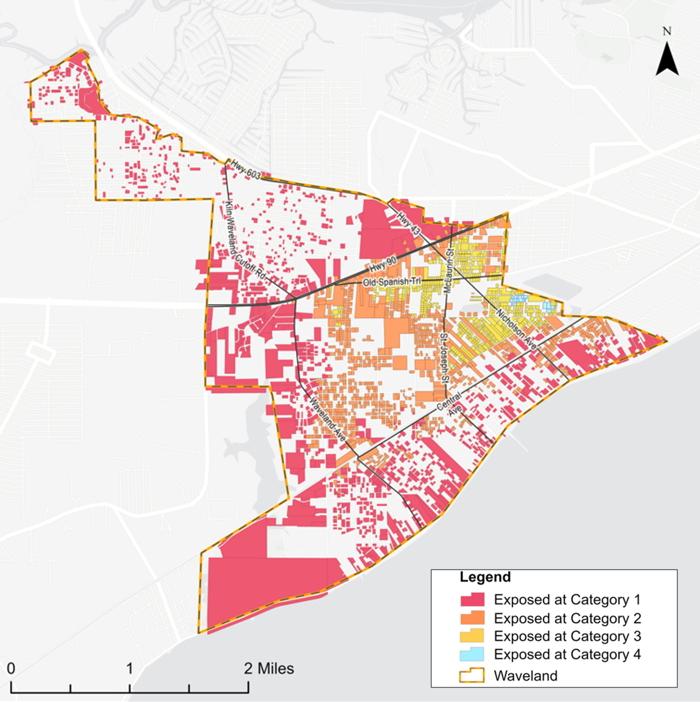
Multi-Hazard Exposure Assessment: Mapped storm surge, high-tide flooding, stormwater flooding, FEMA 100- and 500-year floodplains, and shoreline change to characterize the city’s exposure to multiple hazards.
Flood Insurance Analysis: Analyzed NFIP policy and claims data and identified patterns of insurance participation to support flood mitigation priorities.
Repetitive Loss Area Analysis
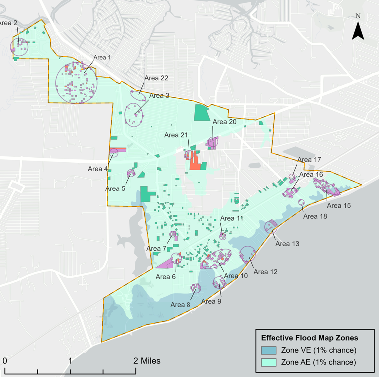
- Repetitive Loss Area Delineation: Analyzed FEMA repetitive loss records and NFIP claims data to identify and map areas with concentrations of repetitive flood losses.
Substantial Damage Management Plan
- Substantial Damage Assessment & Mapping: Identified and mapped properties potentially subject to substantial damage determinations and entered property information into FEMA’s Substantial Damage Estimator (SDE) tool.
- SDE Guidance & Documentation: Developed a user guide to help municipal staff navigate the SDE tool and conduct substantial damage assessments.
Data
FEMA NFIP Claims & Policies • County parcel data • NOAA sea level rise and high tide flooding • SLOSH storm surge • MDEQ digital elevation model • USGS Shorelines • HUC watersheds
Application
Together, these analyses help the city identify areas most vulnerable to flooding, understand patterns of flood insurance participation and repetitive losses, and prioritize future flood mitigation efforts.