Bay St. Louis | CRS Activity 510
Overview
This ongoing project supports the City of Bay St. Louis, Mississippi, in developing floodplain management planning documents under FEMA’s Community Rating System (CRS) Activity 510.
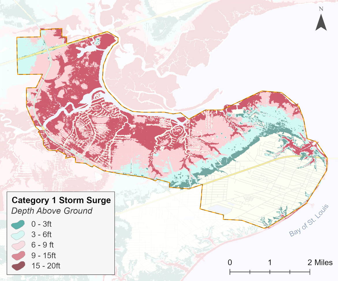
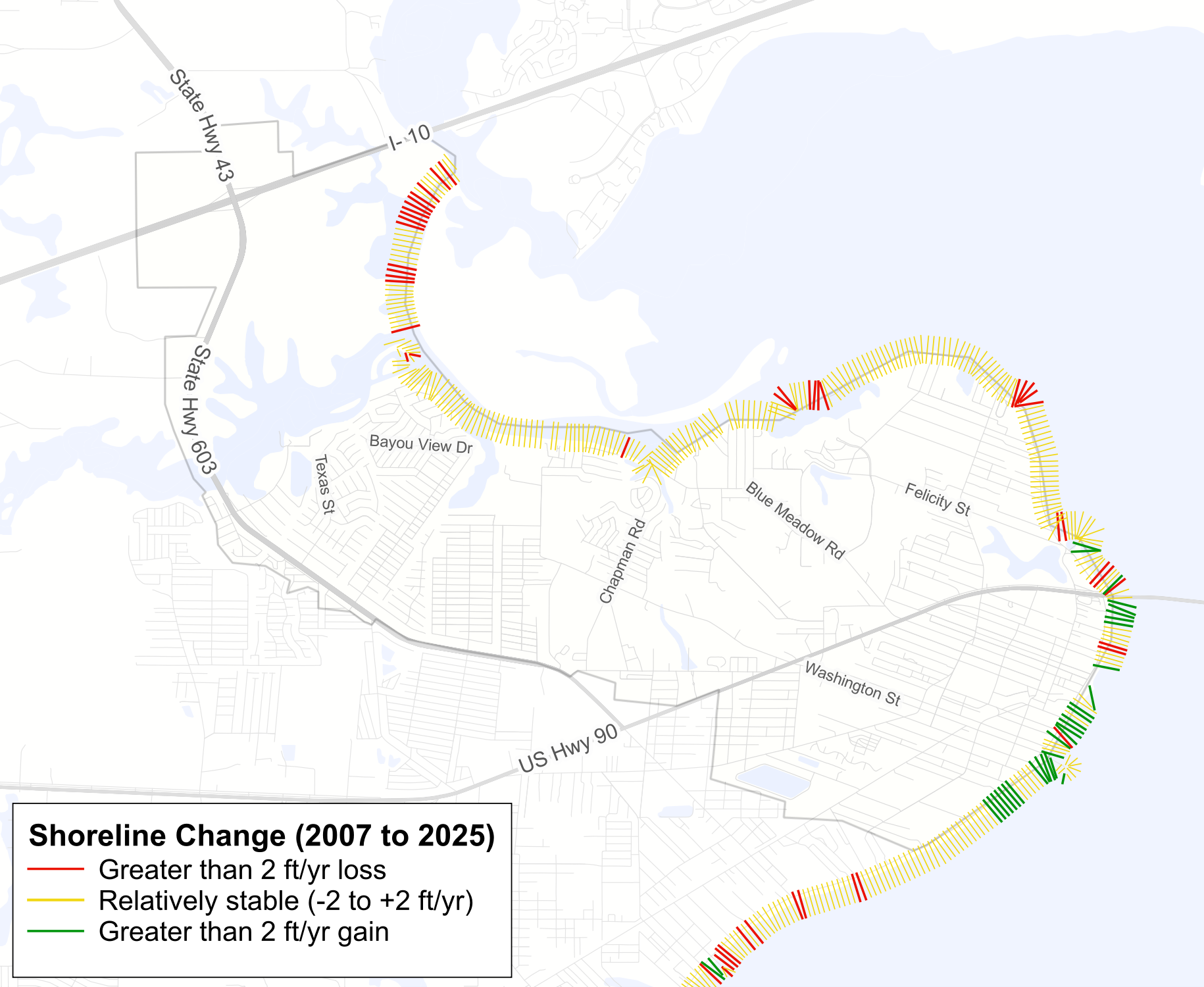
The project integrates flood hazard, property, infrastructure, and insurance data to characterize the city’s exposure to multiple flooding hazards and inform local flood mitigation priorities. Additional analysis of historical shoreline change examines patterns of coastal erosion and accretion to better understand changes along the city’s waterfront.
My Role & Contributions
Community Engagement & Planning
- Developed flood risk maps and spatial analyses, contributed to planning documents, and participated in stakeholder engagement to support local floodplain management strategies.
Floodplain Management Plan
- Multi-Hazard Exposure Assessment: Mapped storm surge, high-tide flooding, stormwater flooding, and FEMA 100- and 500-year floodplains to identify areas and assets exposed to multiple flood hazards.
Flood Insurance & Repetitive Loss Analysis: Analyzed NFIP policy and claims data to examine flood insurance participation and patterns of repetitive flood losses.
Shoreline Change Analysis: Used historical National Agriculture Imagery Program (NAIP) aerial imagery to delineate shoreline positions and assess coastal erosion and accretion between 2007 and 2025. Calculated net shoreline movement and end point rate along transects to quantify the magnitude and rate of shoreline change.
Data:
County parcel data • NOAA sea level rise • SLOSH storm surge • NAIP Imagery
Application
These analyses support the city’s floodplain management planning by identifying areas vulnerable to flooding, examining insurance coverage and repetitive flood losses, and informing potential mitigation priorities.